© Government of Yukon 2011
 YUKON
YUKON
MAP
There are high mountains and forests in Yukon.
Canada's highest peak, Mount Logan is in the southwest corner of Yukon.
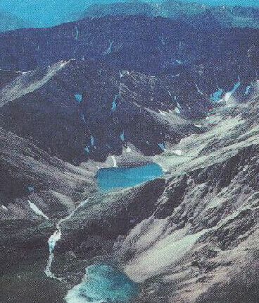
Glaciers have carved out mountains
and valleys in Kluane National Park.
Old Crow Flats in northern Yukon is an area covered with hundreds of
lakes, rivers and streams. It is a maze of waterways. Moose, three
species of bears, the wolf, wolverine and many other kinds of wildlife
live here. The many streams provide homes for muskrats. This
area is also an important waterfowl habitat.
Part of the land in the north is called "tundra".
Not many plants are able to grow there because of the frozen ground.
Yukon lies north of the province of British Columbia.
It was named after the large river that flows through it.
Besides the Yukon River there are several other large rivers.
the Yukon River is the second-largest
river in Canada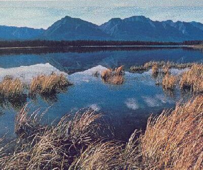
Kluane National Park 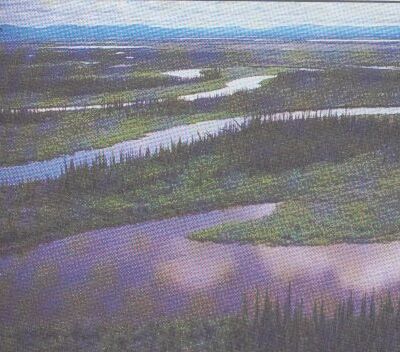
Old Crow Flats 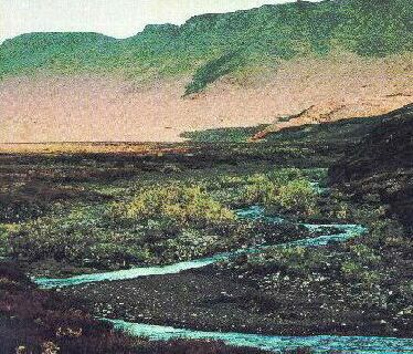
Richardson mountains
 MADE IN CANADA
INDEX
MADE IN CANADA
INDEX